Geolocate

Imón topographic map

Click on the map to display elevation.

About this map
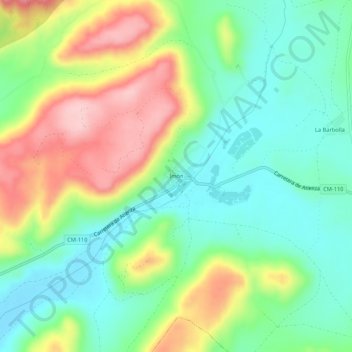
Name: Imón topographic map, elevation, terrain.

Location: Imón, Sigüenza, Guadalajara, Castilla-La Mancha, España (41.14130 -2.75427 41.18130 -2.71427)

Average elevation: 3,238 ft

Minimum elevation: 3,005 ft

Maximum elevation: 3,632 ft

Other topographic maps

Click on a map to view its topography, its elevation and its terrain.

Embalse de Atance

España > Castilla-La Mancha > Sigüenza

Average elevation: 3,248 ft

Riosalido

España > Castilla-La Mancha > Sigüenza

Average elevation: 3,415 ft

Embalse de Atance

España > Castilla-La Mancha > Sigüenza

Average elevation: 3,248 ft

Gear up for your next adventure:

🧤Tactile Hiking Gloves - Keep hands warm while operating GPS and smartphone screens
🎒Hydration Pack - Hands‑free water reservoir for long hikes
🧦Merino Wool Socks - Moisture-wicking, blister-preventing socks for long treks
🩹Survival Bandages - High‑quality bandages for emergencies
📶Vehicle Signal Boosters - Improve reception in rural areas while driving to trailheads

As an Amazon Associate, this site earns from qualifying purchases at no extra cost to you.