Geolocate

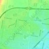
Norlane topographic map

Click on the map to display elevation.

About this map

Name: Norlane topographic map, elevation, terrain.

Location: Norlane, Geelong, Victoria, Australia (-38.10593 144.33503 -38.08155 144.37192)

Average elevation: 56 ft

Minimum elevation: -26 ft

Maximum elevation: 125 ft

Other topographic maps

Click on a map to view its topography, its elevation and its terrain.
Armstrong Creek

Australia > Victoria > Geelong

Average elevation: 154 ft

Buckley Falls Park

Australia > Victoria > Geelong

Average elevation: 141 ft

Hume Reserve

Australia > Victoria > Geelong

Average elevation: 105 ft

Mount Duneed

Australia > Victoria > Geelong

Average elevation: 184 ft

Wombat Hill

Australia > Victoria > Geelong

Average elevation: 131 ft

Vincent Park

Australia > Victoria > Geelong

Average elevation: 33 ft

Lincoln Reserve

Australia > Victoria > Geelong

Average elevation: 62 ft

Gear up for your next adventure:

🚁Photography Drones - Capture stunning aerial views of landforms and topography
🧭GPS Watch Accessories - Bands and chargers for GPS watches
📷Action Cameras - Rugged cameras to document your journeys across rugged terrain
🛰️Handheld GPS Units - Professional satellite navigators for precise backcountry mapping
🔦Powerful Headlamps - Ultra-bright hands-free lighting for night navigation

As an Amazon Associate, this site earns from qualifying purchases at no extra cost to you.