Geolocate

Zoverallo topographic map

Click on the map to display elevation.

About this map
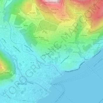
Name: Zoverallo topographic map, elevation, terrain.

Location: Zoverallo, Verbania, Verbano-Cusio-Ossola, Piedmont, 28921, Italy (45.92696 8.55464 45.96696 8.59464)

Average elevation: 1,056 ft

Minimum elevation: 620 ft

Maximum elevation: 2,516 ft

Other topographic maps

Click on a map to view its topography, its elevation and its terrain.
Gear up for your next adventure:

🪓Survival Multi‑Tool - Versatile tool for camp and trail tasks
🔦LED Headlamp - Bright and durable LED headlamp for night navigation
🛡️Bear Spray Outdoor - Protection in bear country hikes
🧭Outdoor Navigation Book - Learn advanced navigation skills
🥩Freeze-Dried Meals - Nutritious and lightweight food for remote expeditions

As an Amazon Associate, this site earns from qualifying purchases at no extra cost to you.