Geolocate

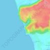
Chopdem topographic map

Click on the map to display elevation.

About this map

Name: Chopdem topographic map, elevation, terrain.

Location: Chopdem, Pernem, North Goa, Goa, 403512, India (15.61795 73.73478 15.65795 73.77478)

Average elevation: 79 ft

Minimum elevation: -7 ft

Maximum elevation: 302 ft

Other topographic maps

Click on a map to view its topography, its elevation and its terrain.
Arambol Sweet Water Lake

India > Goa > Pernem > Arambol

Average elevation: 82 ft

Morjim Beach

India > Goa > Pernem

Average elevation: 10 ft

Gear up for your next adventure:

🔪Outdoor Multitools - Essential survival tools for gear repair and field use
📷Action Cameras - Rugged cameras to document your journeys across rugged terrain
👓Polarized Sunglasses - Outdoor sunglasses for glare reduction
🚪Portable Camp Chair - Foldable chair for comfort at camp
📡GPS Antenna Upgrade - Enhance GPS reception in remote terrain

As an Amazon Associate, this site earns from qualifying purchases at no extra cost to you.