Geolocate

Mumias topographic map

Click on the map to display elevation.

About this map
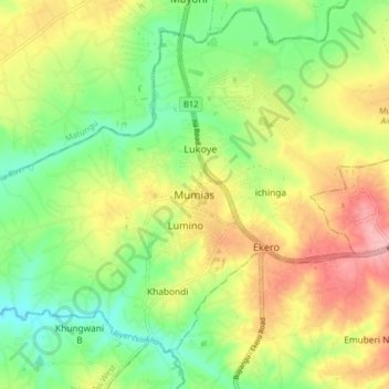
Name: Mumias topographic map, elevation, terrain.

Location: Mumias, Mumias Central ward, Mumias West, Kakamega County, Kenya (0.29611 34.44954 0.37611 34.52954)

Average elevation: 4,268 ft

Minimum elevation: 4,085 ft

Maximum elevation: 4,501 ft

Gear up for your next adventure:

🍳Camping Cook Set - Complete cookware for outdoor meals
📌Outdoor GPS Map App - Apps and devices for digital topographic navigation
💧Water Purification System - Clean water on the trail with reliable purifiers
🔥Camping Stove - Portable stove for camping and backcountry cooking
🎒Hydration Pack - Hands‑free water reservoir for long hikes

As an Amazon Associate, this site earns from qualifying purchases at no extra cost to you.