Geolocate

Kollengode topographic map

Click on the map to display elevation.

About this map
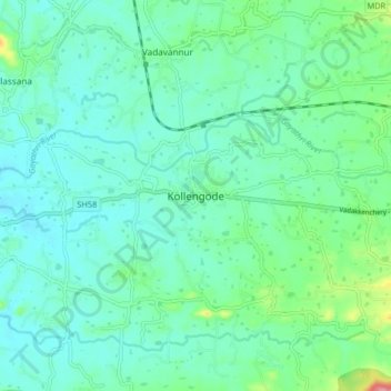
Name: Kollengode topographic map, elevation, terrain.

Location: Kollengode, Chittur, Palakkad, Kerala, 678506, India (10.57254 76.65739 10.65254 76.73739)

Average elevation: 338 ft

Minimum elevation: 259 ft

Maximum elevation: 646 ft

Other topographic maps

Click on a map to view its topography, its elevation and its terrain.

Parambikulam

India > Kerala > Chittur

Average elevation: 2,283 ft

Meenkara Dam

India > Kerala > Chittur > Govindapuram

Average elevation: 509 ft

Chittur-Thathamangalam

India > Kerala > Chittur > Manchira

Average elevation: 384 ft

Kaikatty

India > Kerala > Chittur

Average elevation: 3,048 ft

Gear up for your next adventure:

🥾Women's Hiking Boots - Top-rated trail boots with ankle support and superior grip
🧺Microfiber Travel Towels - Compact and fast-drying towels for trail use
🛠️Backpacking Tool Kit - Essential toolkit for outdoor repairs
🔦Compact Flashlight - Reliable flashlight for emergencies
🌲Outdoor Survival Books - Best books on survival skills

As an Amazon Associate, this site earns from qualifying purchases at no extra cost to you.