
Thank you for supporting this site ❤️
Make a donation
Make a donation
Gear up for your next adventure:
As an Amazon Associate, this site earns from qualifying purchases at no extra cost to you.
Münchhausen topographic map
Click on the map to display elevation.
Thank you for supporting this site ❤️
Make a donation
Make a donation
Gear up for your next adventure:
As an Amazon Associate, this site earns from qualifying purchases at no extra cost to you.
About this map
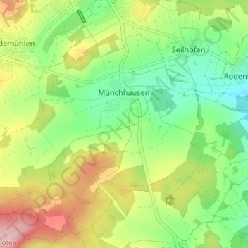
Name: Münchhausen topographic map, elevation, terrain.
Location: Münchhausen, Driedorf, Lahn-Dill-Kreis, Hessen, Deutschland (50.59872 8.14888 50.62704 8.20989)
Average elevation: 1,634 ft
Minimum elevation: 1,381 ft
Maximum elevation: 2,001 ft
Thank you for supporting this site ❤️
Make a donation
Make a donation
Gear up for your next adventure:
As an Amazon Associate, this site earns from qualifying purchases at no extra cost to you.