Geolocate

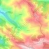
Picos Albos topographic map

Click on the map to display elevation.

About this map

Name: Picos Albos topographic map, elevation, terrain.

Location: Picos Albos, Éndriga, Somiedo, Asturias, España (43.03358 -6.13254 43.05358 -6.11254)

Average elevation: 5,935 ft

Minimum elevation: 4,908 ft

Maximum elevation: 6,834 ft

Other topographic maps

Click on a map to view its topography, its elevation and its terrain.
Valle de Lago

España > Asturias > Somiedo

Average elevation: 5,325 ft

Parque Natural de Somiedo

España > Asturias > Somiedo

Average elevation: 4,262 ft

Las Morteras

España > Asturias > Somiedo

Average elevation: 4,055 ft

Laguna de Calabazosa

España > Asturias > Somiedo

Average elevation: 5,863 ft

Clavillas

España > Asturias > Somiedo

Average elevation: 3,025 ft

La Riera

España > Asturias > Somiedo

Average elevation: 2,753 ft

Valle del Lago

España > Asturias > Somiedo

Average elevation: 5,325 ft

Gear up for your next adventure:

🧯Emergency Survival Kit - All‑in‑one survival essentials for the backcountry
🦶Carbon Trekking Poles - Reduce knee impact on steep descents with ultra-light poles
🔌USB Car Charger - Car charger for on‑the‑go power needs
🥩Freeze-Dried Meals - Nutritious and lightweight food for remote expeditions
🕶️Glacier Sunglasses - Side shields to protect eyes from high-altitude snow glare

As an Amazon Associate, this site earns from qualifying purchases at no extra cost to you.