Geolocate

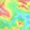
Viego topographic map

Click on the map to display elevation.

About this map

Name: Viego topographic map, elevation, terrain.

Location: Viego, Ponga, Asturias, España (43.13069 -5.15501 43.23319 -5.09652)

Average elevation: 3,156 ft

Minimum elevation: 771 ft

Maximum elevation: 5,968 ft

Other topographic maps

Click on a map to view its topography, its elevation and its terrain.
Sobrefoz

España > Asturias > Ponga

Average elevation: 3,058 ft

Taranes

España > Asturias > Ponga

Average elevation: 2,992 ft

Ambingue

España > Asturias > Ponga

Average elevation: 2,057 ft

Tiatordos

España > Asturias > Ponga

Average elevation: 4,656 ft

San Juan de Beleño

España > Asturias > Ponga

Average elevation: 2,579 ft

Gear up for your next adventure:

🎁Geography Themed Gifts - Unique gift ideas for map lovers and geography enthusiasts
🌐World Map Poster - Decorative world maps with topographic info
🥇GPS Hiking Watch - Multi‑sport GPS watch with navigation and trail tracking
🚪Portable Camp Chair - Foldable chair for comfort at camp
🌧️Backpack Rain Cover - Keep gear dry in wet weather

As an Amazon Associate, this site earns from qualifying purchases at no extra cost to you.