Geolocate

Potter topographic map

Click on the map to display elevation.

About this map

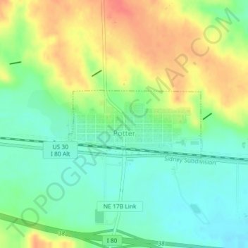
Name: Potter topographic map, elevation, terrain.

Location: Potter, Cheyenne County, Nebraska, United States (41.21466 -103.32365 41.22205 -103.30448)

Average elevation: 4,429 ft

Minimum elevation: 4,354 ft

Maximum elevation: 4,531 ft

Cheyenne County trails, hiking, mountain biking, running and outdoor activities

Other topographic maps

Click on a map to view its topography, its elevation and its terrain.

Lorenzo

United States > Nebraska > Cheyenne County

Average elevation: 4,377 ft

Gear up for your next adventure:

Solar GPS Watches - Advanced multisport watches with built-in topographic maps
🥄Camping Utensil Set - Lightweight utensils for outdoor meals
🎒Day Hiking Backpack - Lightweight backpack perfect for day trips and outdoor adventures
🏥Hiking First Aid Kits - Comprehensive medical kits for remote trail injuries
👓Polarized Sunglasses - Outdoor sunglasses for glare reduction

As an Amazon Associate, this site earns from qualifying purchases at no extra cost to you.