Geolocate

Wednesfield topographic map

Click on the map to display elevation.

About this map
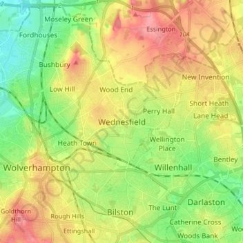
Name: Wednesfield topographic map, elevation, terrain.

Location: Wednesfield, Wolverhampton, West Midlands, England, WV11 1XU, United Kingdom (52.55983 -2.12130 52.63983 -2.04130)

Average elevation: 472 ft

Minimum elevation: 335 ft

Maximum elevation: 633 ft

Other topographic maps

Click on a map to view its topography, its elevation and its terrain.
Gear up for your next adventure:

🪶Survival Guide Book - Expert advice for emergency preparedness
🪄Magnetic Compass - Accurate compass for navigation
🔦Powerful Headlamps - Ultra-bright hands-free lighting for night navigation
🌧️Backpack Rain Cover - Keep gear dry in wet weather
🏔️Mountain Trail Maps - High‑detail maps for popular peaks

As an Amazon Associate, this site earns from qualifying purchases at no extra cost to you.