
Thank you for supporting this site ❤️
Make a donation
Make a donation
Gear up for your next adventure:
As an Amazon Associate, this site earns from qualifying purchases at no extra cost to you.
Knetzgau topographic map
Click on the map to display elevation.
Thank you for supporting this site ❤️
Make a donation
Make a donation
Gear up for your next adventure:
As an Amazon Associate, this site earns from qualifying purchases at no extra cost to you.
About this map
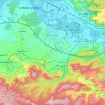
Name: Knetzgau topographic map, elevation, terrain.
Location: Knetzgau, Landkreis Haßberge, Bavaria, 97478, Germany (49.92943 10.44383 50.02651 10.58237)
Average elevation: 1,004 ft
Minimum elevation: 712 ft
Maximum elevation: 1,617 ft
Thank you for supporting this site ❤️
Make a donation
Make a donation
Gear up for your next adventure:
As an Amazon Associate, this site earns from qualifying purchases at no extra cost to you.