
Thank you for supporting this site ❤️
Make a donation
Make a donation
Gear up for your next adventure:
As an Amazon Associate, this site earns from qualifying purchases at no extra cost to you.
Cardonal topographic map
Click on the map to display elevation.
Thank you for supporting this site ❤️
Make a donation
Make a donation
Gear up for your next adventure:
As an Amazon Associate, this site earns from qualifying purchases at no extra cost to you.
About this map
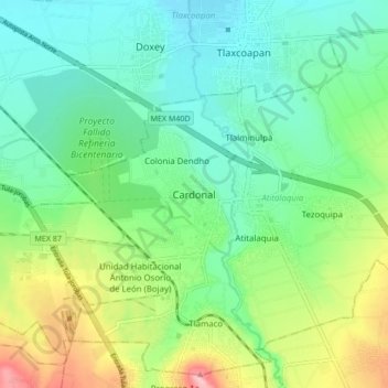
Name: Cardonal topographic map, elevation, terrain.
Location: Cardonal, Atitalaquia, Hidalgo, 42970, Mexico (20.02044 -99.27289 20.10044 -99.19289)
Average elevation: 6,926 ft
Minimum elevation: 6,755 ft
Maximum elevation: 7,316 ft
Thank you for supporting this site ❤️
Make a donation
Make a donation
Gear up for your next adventure:
As an Amazon Associate, this site earns from qualifying purchases at no extra cost to you.