
Ways topographic map
Interactive map
Click on the map to display elevation.
About this map
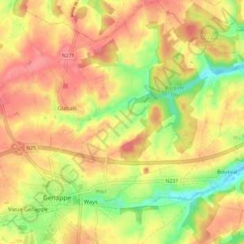
Name: Ways topographic map, elevation, terrain.
Location: Ways, Genepiën, Nijvel, Waals-Brabant, Wallonië, 1474, België (50.60097 4.44850 50.65325 4.48939)
Average elevation: 397 ft
Minimum elevation: 253 ft
Maximum elevation: 495 ft
Other topographic maps
Click on a map to view its topography, its elevation and its terrain.
Houtain-le-Val
Houtain-le-Val, Genepiën, Waals-Brabant, Wallonië, 1476, België
Average elevation: 492 ft