
Thank you for supporting this site ❤️
Make a donation
Make a donation
Gear up for your next adventure:
As an Amazon Associate, this site earns from qualifying purchases at no extra cost to you.
Salawas topographic map
Click on the map to display elevation.
Thank you for supporting this site ❤️
Make a donation
Make a donation
Gear up for your next adventure:
As an Amazon Associate, this site earns from qualifying purchases at no extra cost to you.
About this map
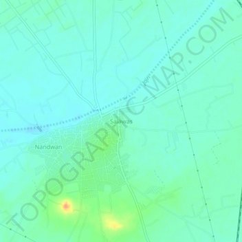
Name: Salawas topographic map, elevation, terrain.
Location: Salawas, Luni Tehsil, Jodhpur District, Rajasthan, India (26.10583 72.96917 26.14583 73.00917)
Average elevation: 636 ft
Minimum elevation: 607 ft
Maximum elevation: 725 ft
Thank you for supporting this site ❤️
Make a donation
Make a donation
Gear up for your next adventure:
As an Amazon Associate, this site earns from qualifying purchases at no extra cost to you.