Geolocate

Erasbach topographic map

Click on the map to display elevation.

Erasbach

Das Kirchdorf liegt auf circa 406 m ü. NHN in der Ebene südlich des Bogens, den der Main-Donau-Kanal von Richtung Berching aus nach Richtung Hilpoltstein macht, nördlich eines Höhenzuges, der mit dem Röschberg bis auf 564 m ü. NHN ansteigt.

Wikipedia (CC-BY-SA 3.0)

About this map

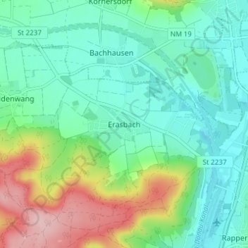
Name: Erasbach topographic map, elevation, terrain.

Location: Erasbach, Berching, Landkreis Neumarkt in der Oberpfalz, Bayern, 92360, Deutschland (49.12635 11.40060 49.16635 11.44060)

Average elevation: 1,427 ft

Minimum elevation: 1,257 ft

Maximum elevation: 1,850 ft

Gear up for your next adventure:

📷Action Camera - Capture your outdoor adventures in HD
💧Water Purification System - Clean water on the trail with reliable purifiers
🗺️Topographic Maps - Detailed topo maps for hiking, exploring and outdoor navigation
📡GPS Antenna Upgrade - Enhance GPS reception in remote terrain
🌡️Handheld Weather Meters - Measure wind, temp, and pressure for safe mountain travel

As an Amazon Associate, this site earns from qualifying purchases at no extra cost to you.