Geolocate

Majkhali topographic map

Click on the map to display elevation.

About this map

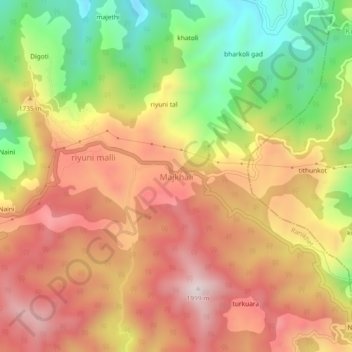
Name: Majkhali topographic map, elevation, terrain.

Location: Majkhali, Ranikhet, Almora, Uttarakhand, 263652, India (29.65819 79.49630 29.69819 79.53630)

Average elevation: 5,453 ft

Minimum elevation: 4,242 ft

Maximum elevation: 6,437 ft

Gear up for your next adventure:

😴Insulated Sleeping Pads - Compact and warm pads for high-elevation camping
🪓Survival Multi‑Tool - Versatile tool for camp and trail tasks
📚Navigation Handbooks - Master the art of reading topographic maps and using a compass
🪵Folding Camp Saw - Compact saw for wood and campsite work
🔥Fast-Boil Camping Stoves - Efficient cooking systems for quick trail meals

As an Amazon Associate, this site earns from qualifying purchases at no extra cost to you.