
Thank you for supporting this site ❤️
Make a donation
Make a donation
Gear up for your next adventure:
As an Amazon Associate, this site earns from qualifying purchases at no extra cost to you.
Olgii topographic map
Click on the map to display elevation.
Thank you for supporting this site ❤️
Make a donation
Make a donation
Gear up for your next adventure:
As an Amazon Associate, this site earns from qualifying purchases at no extra cost to you.
About this map
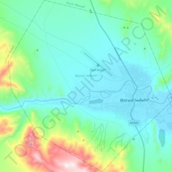
Name: Olgii topographic map, elevation, terrain.
Location: Olgii, Bayan-Ölgii, Mongolia (48.91603 89.82233 49.04074 90.00407)
Average elevation: 6,257 ft
Minimum elevation: 5,604 ft
Maximum elevation: 8,898 ft
Thank you for supporting this site ❤️
Make a donation
Make a donation
Gear up for your next adventure:
As an Amazon Associate, this site earns from qualifying purchases at no extra cost to you.