
Thank you for supporting this site ❤️
Make a donation
Make a donation
Gear up for your next adventure:
As an Amazon Associate, this site earns from qualifying purchases at no extra cost to you.
Mondarruego topographic map
Click on the map to display elevation.
Thank you for supporting this site ❤️
Make a donation
Make a donation
Gear up for your next adventure:
As an Amazon Associate, this site earns from qualifying purchases at no extra cost to you.
About this map
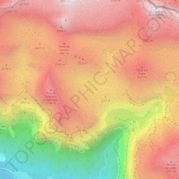
Name: Mondarruego topographic map, elevation, terrain.
Location: Mondarruego, Fanlo, Sobrarbe, Huesca, Aragon, Espagne (42.64958 -0.06702 42.68958 -0.02702)
Average elevation: 7,582 ft
Minimum elevation: 4,088 ft
Maximum elevation: 9,810 ft
Thank you for supporting this site ❤️
Make a donation
Make a donation
Gear up for your next adventure:
As an Amazon Associate, this site earns from qualifying purchases at no extra cost to you.