
Thank you for supporting this site ❤️
Make a donation
Make a donation
Gear up for your next adventure:
As an Amazon Associate, this site earns from qualifying purchases at no extra cost to you.
Coolidge topographic map
Click on the map to display elevation.
Thank you for supporting this site ❤️
Make a donation
Make a donation
Gear up for your next adventure:
As an Amazon Associate, this site earns from qualifying purchases at no extra cost to you.
About this map
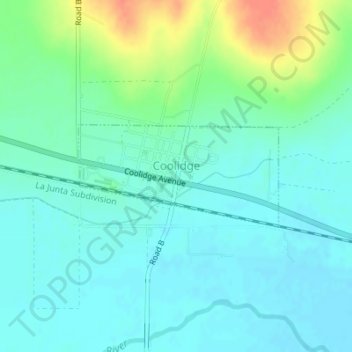
Name: Coolidge topographic map, elevation, terrain.
Location: Coolidge, Hamilton County, Kansas, 67836, United States (38.03693 -102.01835 38.04481 -101.99883)
Average elevation: 3,369 ft
Minimum elevation: 3,327 ft
Maximum elevation: 3,484 ft
Hamilton County trails, hiking, mountain biking, running and outdoor activities
Thank you for supporting this site ❤️
Make a donation
Make a donation
Gear up for your next adventure:
As an Amazon Associate, this site earns from qualifying purchases at no extra cost to you.