
Thank you for supporting this site ❤️
Make a donation
Make a donation
Gear up for your next adventure:
As an Amazon Associate, this site earns from qualifying purchases at no extra cost to you.
Pore topographic map
Click on the map to display elevation.
Thank you for supporting this site ❤️
Make a donation
Make a donation
Gear up for your next adventure:
As an Amazon Associate, this site earns from qualifying purchases at no extra cost to you.
About this map
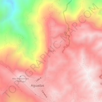
Name: Pore topographic map, elevation, terrain.
Location: Pore, Aguadas, Norte, Caldas, RAP Eje Cafetero, Colombia (5.60665 -75.47226 5.64665 -75.43226)
Average elevation: 6,342 ft
Minimum elevation: 3,645 ft
Maximum elevation: 7,546 ft
Thank you for supporting this site ❤️
Make a donation
Make a donation
Gear up for your next adventure:
As an Amazon Associate, this site earns from qualifying purchases at no extra cost to you.