Geolocate

Pachaca topographic map

Click on the map to display elevation.

About this map

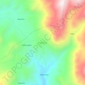
Name: Pachaca topographic map, elevation, terrain.

Location: Pachaca, Ocaña, Lucanas, Ayacucho, Perú (-14.33125 -74.79319 -14.29125 -74.75319)

Average elevation: 11,693 ft

Minimum elevation: 10,636 ft

Maximum elevation: 13,271 ft

Gear up for your next adventure:

🔥Plasma Lighters - Windproof lighters that work in any weather condition
🌲Outdoor Survival Books - Best books on survival skills
🛏️Cold Weather Sleeping Bag - Warm sleeping bag for cold conditions
📡GPS Antenna Upgrade - Enhance GPS reception in remote terrain
🔭Stargazing Telescopes - Perfect for camping in low-light pollution areas shown on maps

As an Amazon Associate, this site earns from qualifying purchases at no extra cost to you.