
Thank you for supporting this site ❤️
Make a donation
Make a donation
Gear up for your next adventure:
As an Amazon Associate, this site earns from qualifying purchases at no extra cost to you.
Cintoia topographic map
Click on the map to display elevation.
Thank you for supporting this site ❤️
Make a donation
Make a donation
Gear up for your next adventure:
As an Amazon Associate, this site earns from qualifying purchases at no extra cost to you.
About this map
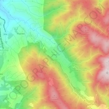
Name: Cintoia topographic map, elevation, terrain.
Location: Cintoia, Greve in Chianti, Firenze, Toscana, 50027, Italia (43.61590 11.31991 43.65590 11.35991)
Average elevation: 1,437 ft
Minimum elevation: 545 ft
Maximum elevation: 2,369 ft
Thank you for supporting this site ❤️
Make a donation
Make a donation
Gear up for your next adventure:
As an Amazon Associate, this site earns from qualifying purchases at no extra cost to you.