
Thank you for supporting this site ❤️
Make a donation
Make a donation
Gear up for your next adventure:
As an Amazon Associate, this site earns from qualifying purchases at no extra cost to you.
Contovello topographic map
Click on the map to display elevation.
Thank you for supporting this site ❤️
Make a donation
Make a donation
Gear up for your next adventure:
As an Amazon Associate, this site earns from qualifying purchases at no extra cost to you.
About this map
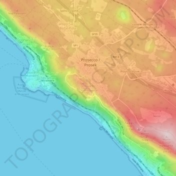
Name: Contovello topographic map, elevation, terrain.
Location: Contovello, Trieste, Friuli-Venezia Giulia, 34151, Italia (45.68253 13.71280 45.72253 13.75280)
Average elevation: 476 ft
Minimum elevation: -3 ft
Maximum elevation: 1,198 ft
Thank you for supporting this site ❤️
Make a donation
Make a donation
Gear up for your next adventure:
As an Amazon Associate, this site earns from qualifying purchases at no extra cost to you.