
Viera topographic map
Click on the map to display elevation.
About this map
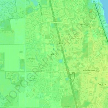
Name: Viera topographic map, elevation, terrain.
Location: Viera, Brevard County, Florida, 32940, United States (28.20301 -80.77015 28.28301 -80.69015)
Average elevation: 30 ft
Minimum elevation: -7 ft
Maximum elevation: 49 ft
Brevard County trails, hiking, mountain biking, running and outdoor activities
Other topographic maps
Click on a map to view its topography, its elevation and its terrain.