
Caio topographic map
Interactive map
Click on the map to display elevation.
About this map
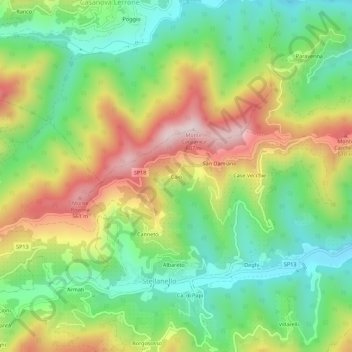
Name: Caio topographic map, elevation, terrain.
Location: Caio, SV, Liguria, 17033, Italy (43.99227 8.04074 44.03227 8.08074)
Average elevation: 925 ft
Minimum elevation: 269 ft
Maximum elevation: 1,880 ft