
Make a donation
Gear up for your next adventure:
As an Amazon Associate, this site earns from qualifying purchases at no extra cost to you.
El Espinar topographic map
Click on the map to display elevation.
Make a donation
Gear up for your next adventure:
As an Amazon Associate, this site earns from qualifying purchases at no extra cost to you.
El Espinar
The documented history of El Espinar dates from the 11th century, even though the area has been inhabited since the Iron Age. In fact, in September 2016 was found the settlement of Canto Los Hierros in a nearby mountain located south of town, just at 1,700 metres above sea level. The settlement, dated back to the Iron Age and later reused and expanded by the Romans, covered about 70 hectares and included about 100 houses, few traces of walls and quite a lot of iron items. This kind of ancient settlement at such a high altitude is considered unique within Europe.
Make a donation
Gear up for your next adventure:
As an Amazon Associate, this site earns from qualifying purchases at no extra cost to you.
About this map
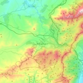
Name: El Espinar topographic map, elevation, terrain.
Location: El Espinar, Segovia, Castile and León, Spain (40.63680 -4.36471 40.80995 -4.07006)
Average elevation: 4,344 ft
Minimum elevation: 2,963 ft
Maximum elevation: 7,185 ft
Make a donation
Gear up for your next adventure:
As an Amazon Associate, this site earns from qualifying purchases at no extra cost to you.
Other topographic maps
Click on a map to view its topography, its elevation and its terrain.
Puente de Domingo Flórez
Spain > Castile and León > El Bierzo > Puente de Domingo Flórez
Average elevation: 1,729 ft
Make a donation
Gear up for your next adventure:
As an Amazon Associate, this site earns from qualifying purchases at no extra cost to you.