
Messel topographic map
Click on the map to display elevation.
About this map
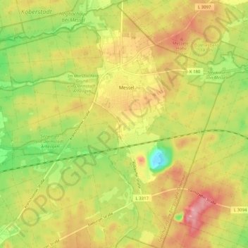
Name: Messel topographic map, elevation, terrain.
Location: Messel, Landkreis Darmstadt-Dieburg, Hesse, 64409, Germany (49.89480 8.72627 49.96013 8.79676)
Average elevation: 551 ft
Minimum elevation: 348 ft
Maximum elevation: 732 ft
Other topographic maps
Click on a map to view its topography, its elevation and its terrain.
UNESCO Weltnaturerbe Grube Messel
Germany > Hesse > Landkreis Darmstadt-Dieburg > Messel
Average elevation: 561 ft