Make a donation
Gear up for your next adventure:
As an Amazon Associate, this site earns from qualifying purchases at no extra cost to you.
Mukhem topographic map
Click on the map to display elevation.
Make a donation
Gear up for your next adventure:
As an Amazon Associate, this site earns from qualifying purchases at no extra cost to you.
About this map
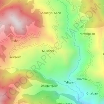
Name: Mukhem topographic map, elevation, terrain.
Location: Mukhem, Pratapnagar, Tehri Garhwal, Uttarakhand, India (30.57199 78.46139 30.58063 78.47453)
Average elevation: 6,270 ft
Minimum elevation: 5,049 ft
Maximum elevation: 7,552 ft
Make a donation
Gear up for your next adventure:
As an Amazon Associate, this site earns from qualifying purchases at no extra cost to you.
Other topographic maps
Click on a map to view its topography, its elevation and its terrain.
Make a donation
Gear up for your next adventure:
As an Amazon Associate, this site earns from qualifying purchases at no extra cost to you.
