
Thank you for supporting this site ❤️
Make a donation
Make a donation
Gear up for your next adventure:
As an Amazon Associate, this site earns from qualifying purchases at no extra cost to you.
Qardho topographic map
Click on the map to display elevation.
Thank you for supporting this site ❤️
Make a donation
Make a donation
Gear up for your next adventure:
As an Amazon Associate, this site earns from qualifying purchases at no extra cost to you.
About this map
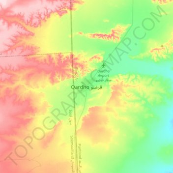
Name: Qardho topographic map, elevation, terrain.
Location: Qardho, Qardho District, Bari, Puntland, Somalia (9.34701 48.92721 9.66701 49.24721)
Average elevation: 2,556 ft
Minimum elevation: 2,238 ft
Maximum elevation: 2,979 ft
Thank you for supporting this site ❤️
Make a donation
Make a donation
Gear up for your next adventure:
As an Amazon Associate, this site earns from qualifying purchases at no extra cost to you.