
Baldy topographic map
Click on the map to display elevation.
About this map
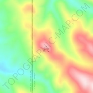
Name: Baldy topographic map, elevation, terrain.
Location: Baldy, Cascade County, Montana, United States (47.02017 -111.78420 47.02027 -111.78410)
Average elevation: 5,036 ft
Minimum elevation: 4,514 ft
Maximum elevation: 5,643 ft
Cascade County trails, hiking, mountain biking, running and outdoor activities
Other topographic maps
Click on a map to view its topography, its elevation and its terrain.
Neihart
United States > Montana > Cascade County
The town has a total area of 1.99 square miles (5.15 km2), all land. Its elevation is 5,661 feet (1,725 m). Neihart is on U.S. Route 89, also known as the Kings Hill Scenic Byway. Snow removal crews work throughout the winter to keep the road open. It is the only town between Monarch to the north and White…
Average elevation: 6,447 ft