
Thank you for supporting this site ❤️
Make a donation
Make a donation
Gear up for your next adventure:
As an Amazon Associate, this site earns from qualifying purchases at no extra cost to you.
Juaraco topographic map
Click on the map to display elevation.
Thank you for supporting this site ❤️
Make a donation
Make a donation
Gear up for your next adventure:
As an Amazon Associate, this site earns from qualifying purchases at no extra cost to you.
About this map
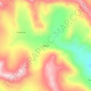
Name: Juaraco topographic map, elevation, terrain.
Location: Juaraco, Cotaruse, Aymaraes, Apurímac, Perú (-14.48419 -73.46884 -14.44419 -73.42884)
Average elevation: 14,652 ft
Minimum elevation: 13,829 ft
Maximum elevation: 15,302 ft
Thank you for supporting this site ❤️
Make a donation
Make a donation
Gear up for your next adventure:
As an Amazon Associate, this site earns from qualifying purchases at no extra cost to you.