
Thank you for supporting this site ❤️
Make a donation
Make a donation
Gear up for your next adventure:
As an Amazon Associate, this site earns from qualifying purchases at no extra cost to you.
Duka topographic map
Click on the map to display elevation.
Thank you for supporting this site ❤️
Make a donation
Make a donation
Gear up for your next adventure:
As an Amazon Associate, this site earns from qualifying purchases at no extra cost to you.
About this map
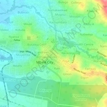
Name: Duka topographic map, elevation, terrain.
Location: Duka, Mbale City, Bugisa sub-region, Eastern Region, Uganda (1.05442 34.15824 1.09442 34.19824)
Average elevation: 3,714 ft
Minimum elevation: 3,625 ft
Maximum elevation: 3,904 ft
Thank you for supporting this site ❤️
Make a donation
Make a donation
Gear up for your next adventure:
As an Amazon Associate, this site earns from qualifying purchases at no extra cost to you.