
Aksay topographic map
Interactive map
Click on the map to display elevation.
About this map
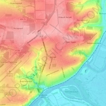
Name: Aksay topographic map, elevation, terrain.
Average elevation: 220 ft
Minimum elevation: 0 ft
Maximum elevation: 404 ft
Other topographic maps
Click on a map to view its topography, its elevation and its terrain.
Rassvet
Russia > Rostov Oblast > Aksaysky District
Rassvet, Рассветовское сельское поселение, Aksaysky District, Rostov Oblast, Southern Federal District, 346735, Russia
Average elevation: 344 ft