
桐木镇 topographic map
Interactive map
Click on the map to display elevation.
About this map
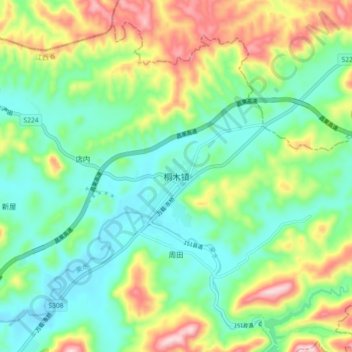
Name: 桐木镇 topographic map, elevation, terrain.
Location: 桐木镇, 上栗县, 萍乡市, 江西省, 中国 (27.92225 113.88712 28.00225 113.96712)
Average elevation: 679 ft
Minimum elevation: 344 ft
Maximum elevation: 1,365 ft
Other topographic maps
Click on a map to view its topography, its elevation and its terrain.