Geolocate

Erna topographic map

Click on the map to display elevation.

About this map

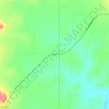
Name: Erna topographic map, elevation, terrain.

Location: Erna, Menard County, Texas, United States (30.73073 -99.50590 30.77073 -99.46590)

Average elevation: 1,781 ft

Minimum elevation: 1,677 ft

Maximum elevation: 1,985 ft

Menard County trails, hiking, mountain biking, running and outdoor activities

Other topographic maps

Click on a map to view its topography, its elevation and its terrain.

Menard

United States > Texas > Menard County

Average elevation: 1,946 ft

Gear up for your next adventure:

Backpacking Tents - Weight-optimized shelters for multi-day topographic surveys
🧼Biodegradable Camping Soap - Eco‑friendly soap for outdoor hygiene
🔭Stargazing Telescopes - Perfect for camping in low-light pollution areas shown on maps
👟Men's Trail Runners - Lightweight footwear for fast-paced exploration and light hiking
👟Trail Running Shoes - Lightweight shoes for trail runners

As an Amazon Associate, this site earns from qualifying purchases at no extra cost to you.