Geolocate

Beckum topographic map

Click on the map to display elevation.

About this map

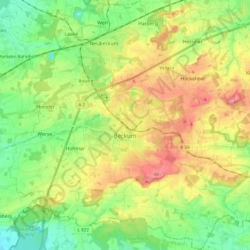
Name: Beckum topographic map, elevation, terrain.

Location: Beckum, Kreis Warendorf, North Rhine-Westphalia, 59269, Germany (51.70169 7.95287 51.81910 8.13756)

Average elevation: 361 ft

Minimum elevation: 213 ft

Maximum elevation: 574 ft

Gear up for your next adventure:

Camping Coffee Makers - Enjoy premium coffee at the summit or campsite
Solar GPS Watches - Advanced multisport watches with built-in topographic maps
📶Vehicle Signal Boosters - Improve reception in rural areas while driving to trailheads
🪑Ultralight Camp Chairs - Portable seating for resting after a long day of mapping
🎒Waterproof Dry Bags - Keep your electronics and maps dry inside your pack

As an Amazon Associate, this site earns from qualifying purchases at no extra cost to you.