
Thank you for supporting this site ❤️
Make a donation
Make a donation
Gear up for your next adventure:
As an Amazon Associate, this site earns from qualifying purchases at no extra cost to you.
Malpasito topographic map
Click on the map to display elevation.
Thank you for supporting this site ❤️
Make a donation
Make a donation
Gear up for your next adventure:
As an Amazon Associate, this site earns from qualifying purchases at no extra cost to you.
About this map
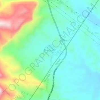
Name: Malpasito topographic map, elevation, terrain.
Location: Malpasito, Huimanguillo, Tabasco, Mexico (17.32513 -93.61145 17.36513 -93.57145)
Average elevation: 791 ft
Minimum elevation: 351 ft
Maximum elevation: 1,919 ft
Thank you for supporting this site ❤️
Make a donation
Make a donation
Gear up for your next adventure:
As an Amazon Associate, this site earns from qualifying purchases at no extra cost to you.