
Thank you for supporting this site ❤️
Make a donation
Make a donation
Gear up for your next adventure:
As an Amazon Associate, this site earns from qualifying purchases at no extra cost to you.
Gaspalha topographic map
Click on the map to display elevation.
Thank you for supporting this site ❤️
Make a donation
Make a donation
Gear up for your next adventure:
As an Amazon Associate, this site earns from qualifying purchases at no extra cost to you.
About this map
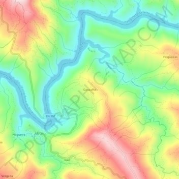
Name: Gaspalha topographic map, elevation, terrain.
Location: Gaspalha, Álvaro, Oleiros, Castelo Branco, 6160-052, Portugal (39.96533 -7.97083 40.00533 -7.93083)
Average elevation: 1,388 ft
Minimum elevation: 879 ft
Maximum elevation: 2,129 ft
Thank you for supporting this site ❤️
Make a donation
Make a donation
Gear up for your next adventure:
As an Amazon Associate, this site earns from qualifying purchases at no extra cost to you.