
Thornwood topographic map
Interactive map
Click on the map to display elevation.
About this map
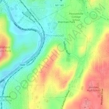
Name: Thornwood topographic map, elevation, terrain.
Average elevation: 397 ft
Minimum elevation: 240 ft
Maximum elevation: 614 ft
Westchester County trails, hiking, mountain biking, running and outdoor activities
Other topographic maps
Click on a map to view its topography, its elevation and its terrain.
Sherman Park
United States > New York > Westchester County > Town of Mount Pleasant > Thornwood
Average elevation: 436 ft