Geolocate

Laguna Azul topographic map

Click on the map to display elevation.

About this map

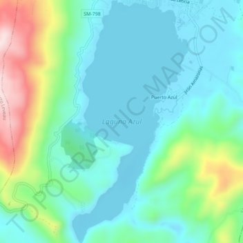
Name: Laguna Azul topographic map, elevation, terrain.

Location: Laguna Azul, Sauce, San Martín, Perú (-6.73493 -76.22811 -6.69216 -76.20761)

Average elevation: 2,290 ft

Minimum elevation: 1,972 ft

Maximum elevation: 3,287 ft

Gear up for your next adventure:

🪶LED Camping Lantern - Bright lantern for camp lighting
🏕️Tent Footprint - Protect your tent base from wear
🥾Women's Hiking Boots - Top-rated trail boots with ankle support and superior grip
🌡️Portable Weather Meter - Track weather conditions on the trail
📡GPS Antenna Upgrade - Enhance GPS reception in remote terrain

As an Amazon Associate, this site earns from qualifying purchases at no extra cost to you.