
Thank you for supporting this site ❤️
Make a donation
Make a donation
Gear up for your next adventure:
As an Amazon Associate, this site earns from qualifying purchases at no extra cost to you.
Corrubedo topographic map
Click on the map to display elevation.
Thank you for supporting this site ❤️
Make a donation
Make a donation
Gear up for your next adventure:
As an Amazon Associate, this site earns from qualifying purchases at no extra cost to you.
About this map
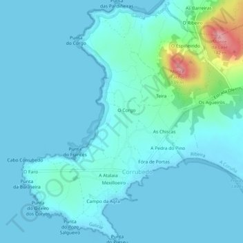
Name: Corrubedo topographic map, elevation, terrain.
Location: Corrubedo, Ribeira, A Barbanza, A Coruña, Galicia, Spain (42.56639 -9.09150 42.59963 -9.05877)
Average elevation: 49 ft
Minimum elevation: -7 ft
Maximum elevation: 417 ft
Thank you for supporting this site ❤️
Make a donation
Make a donation
Gear up for your next adventure:
As an Amazon Associate, this site earns from qualifying purchases at no extra cost to you.