
Thank you for supporting this site ❤️
Make a donation
Make a donation
Gear up for your next adventure:
As an Amazon Associate, this site earns from qualifying purchases at no extra cost to you.
Tua topographic map
Click on the map to display elevation.
Thank you for supporting this site ❤️
Make a donation
Make a donation
Gear up for your next adventure:
As an Amazon Associate, this site earns from qualifying purchases at no extra cost to you.
About this map
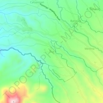
Name: Tua topographic map, elevation, terrain.
Location: Tua, Magallanes, Cavite, Calabarzon, 4113, Philippines (14.11443 120.76058 14.15443 120.80058)
Average elevation: 883 ft
Minimum elevation: 436 ft
Maximum elevation: 1,837 ft
Thank you for supporting this site ❤️
Make a donation
Make a donation
Gear up for your next adventure:
As an Amazon Associate, this site earns from qualifying purchases at no extra cost to you.