
Thank you for supporting this site ❤️
Make a donation
Make a donation
Gear up for your next adventure:
As an Amazon Associate, this site earns from qualifying purchases at no extra cost to you.
Kasapa I topographic map
Click on the map to display elevation.
Thank you for supporting this site ❤️
Make a donation
Make a donation
Gear up for your next adventure:
As an Amazon Associate, this site earns from qualifying purchases at no extra cost to you.
About this map
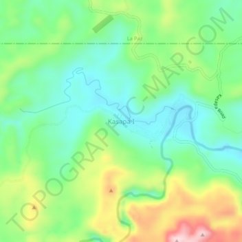
Name: Kasapa I topographic map, elevation, terrain.
Location: Kasapa I, Loreto, Agusan del Sur, Caraga, 8507, Philippines (8.12948 125.61782 8.16948 125.65782)
Average elevation: 522 ft
Minimum elevation: 200 ft
Maximum elevation: 1,138 ft
Thank you for supporting this site ❤️
Make a donation
Make a donation
Gear up for your next adventure:
As an Amazon Associate, this site earns from qualifying purchases at no extra cost to you.