
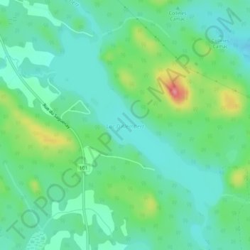
Lac D'Alembert topographic map
Interactive map
Click on the map to display elevation.
About this map
Name: Lac D'Alembert topographic map, elevation, terrain.
Average elevation: 1,024 ft
Minimum elevation: 932 ft
Maximum elevation: 1,270 ft
Other topographic maps
Click on a map to view its topography, its elevation and its terrain.
Rollet
Canada > Quebec > Rouyn-Noranda
Rollet, Rouyn-Noranda, Abitibi-Témiscamingue, Quebec, Canada
Average elevation: 906 ft
Lac Brunet
Canada > Quebec > Rouyn-Noranda
Lac Brunet, Mont-Brun, Rouyn-Noranda, Abitibi-Témiscamingue, Quebec, Canada
Average elevation: 1,283 ft
Lac Labyrinthe
Canada > Quebec > Rouyn-Noranda
Lac Labyrinthe, Arntfield, Rouyn-Noranda, Abitibi-Témiscamingue, Quebec, Canada
Average elevation: 955 ft