
Thank you for supporting this site ❤️
Make a donation
Make a donation
Gear up for your next adventure:
As an Amazon Associate, this site earns from qualifying purchases at no extra cost to you.
Frisoni topographic map
Click on the map to display elevation.
Thank you for supporting this site ❤️
Make a donation
Make a donation
Gear up for your next adventure:
As an Amazon Associate, this site earns from qualifying purchases at no extra cost to you.
About this map
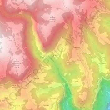
Name: Frisoni topographic map, elevation, terrain.
Location: Frisoni, Stoner, Enego, Vicenza, Veneto, 36052, Italy (45.89693 11.64161 45.93693 11.68161)
Average elevation: 3,596 ft
Minimum elevation: 581 ft
Maximum elevation: 5,098 ft
Thank you for supporting this site ❤️
Make a donation
Make a donation
Gear up for your next adventure:
As an Amazon Associate, this site earns from qualifying purchases at no extra cost to you.