
Make a donation
Gear up for your next adventure:
As an Amazon Associate, this site earns from qualifying purchases at no extra cost to you.
Eppegem topographic map
Click on the map to display elevation.
Make a donation
Gear up for your next adventure:
As an Amazon Associate, this site earns from qualifying purchases at no extra cost to you.
Eppegem
Eppegem ligt aan de Zenne en de Afleiding van de Zenne. De bodem is zandlemig en de hoogte bedraagt ongeveer 10 meter. Belangrijke natuurgebieden zijn.
Make a donation
Gear up for your next adventure:
As an Amazon Associate, this site earns from qualifying purchases at no extra cost to you.
About this map
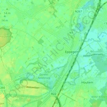
Name: Eppegem topographic map, elevation, terrain.
Average elevation: 36 ft
Minimum elevation: 10 ft
Maximum elevation: 62 ft
Make a donation
Gear up for your next adventure:
As an Amazon Associate, this site earns from qualifying purchases at no extra cost to you.
Other topographic maps
Click on a map to view its topography, its elevation and its terrain.
Zemst-Bos
België > Vlaams-Brabant > Halle-Vilvoorde > Zemst
Ter hoogte van de Kesterbeek ligt het dorp op zo'n 12 meter hoogte, de rest ligt op 13 meter hoogte. Het laagste punt in de omgeving wordt gevormd door de vijver van het Dalemansbos, ten noordoosten van het dorp (11 meter hoogte). De hoogste punten van Zemst-Bos liggen bij Haverenblok en het Zwartland (15…
Average elevation: 36 ft
Zennevallei met het Kasteeldomein van Relegem
België > Vlaams-Brabant > Halle-Vilvoorde > Zemst
Average elevation: 26 ft