Geolocate

Diamante topographic map

Click on the map to display elevation.

About this map

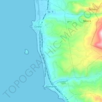
Name: Diamante topographic map, elevation, terrain.

Location: Diamante, Cosenza, Calabria, 87023, Italy (39.66831 15.80017 39.73009 15.84319)

Average elevation: 400 ft

Minimum elevation: -3 ft

Maximum elevation: 2,477 ft

Gear up for your next adventure:

🎒Outdoor Daypacks - Lightweight backpacks designed for carrying maps and essential gear
🦟Ultrasonic Repellers - Create a bug-free zone at your camp or rest stop
🗻Climbing Gear Basics - Essential gear for beginner climbers
📷Action Camera - Capture your outdoor adventures in HD
🛠️Outdoor Gear Repair Kit - Essential tools to fix gear on the trail

As an Amazon Associate, this site earns from qualifying purchases at no extra cost to you.