
Thank you for supporting this site ❤️
Make a donation
Make a donation
Gear up for your next adventure:
As an Amazon Associate, this site earns from qualifying purchases at no extra cost to you.
Smolyan topographic map
Click on the map to display elevation.
Thank you for supporting this site ❤️
Make a donation
Make a donation
Gear up for your next adventure:
As an Amazon Associate, this site earns from qualifying purchases at no extra cost to you.
About this map
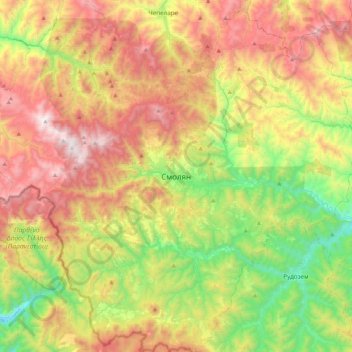
Name: Smolyan topographic map, elevation, terrain.
Location: Smolyan, Smolian, Smolyan, 4700, Bulgaria (41.41682 24.54104 41.73682 24.86104)
Average elevation: 4,203 ft
Minimum elevation: 1,900 ft
Maximum elevation: 7,149 ft
Thank you for supporting this site ❤️
Make a donation
Make a donation
Gear up for your next adventure:
As an Amazon Associate, this site earns from qualifying purchases at no extra cost to you.