Geolocate

Mazuko topographic map

Click on the map to display elevation.

About this map

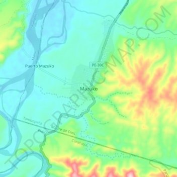
Name: Mazuko topographic map, elevation, terrain.

Location: Mazuko, Inambari, Tambopata, Madre de Dios, Peru (-13.14089 -70.40774 -13.06089 -70.32774)

Average elevation: 1,260 ft

Minimum elevation: 988 ft

Maximum elevation: 2,064 ft

Gear up for your next adventure:

🪑Ultralight Camp Chairs - Portable seating for resting after a long day of mapping
🔌Solar Panel Charger - Charge gear sustainably outdoors
🧦Merino Wool Socks - Moisture-wicking, blister-preventing socks for long treks
🧣Merino Neck Gaiters - Multi-functional headwear for wind and sun protection
🏔️Mountain Trail Maps - High‑detail maps for popular peaks

As an Amazon Associate, this site earns from qualifying purchases at no extra cost to you.